#+filetags :R:spatial:analysis:visualisation:
Turns out it is possible, thanks to the good folks at Stamen Design, to get fairly unobtrusive maps based on the OpenStreetMap data.
Combining this with a SLIP dataset from the Western Australian government on active schools in the state provided a good opportunity to check out the recently released sf (Simple Features) package in R.
Simple features are a standardized way to encode spatial vector data. Support in R was added in November 2016. For users of the tidyverse, this makes manipulating shapefiles and the likes easier, as simple features in R are dataframes!
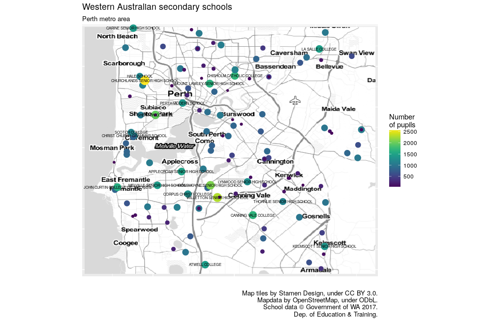
Figure 1: Plot of secondary schools by student population.
Posted on Thursday 12 October 2017 at 21:30